— 001
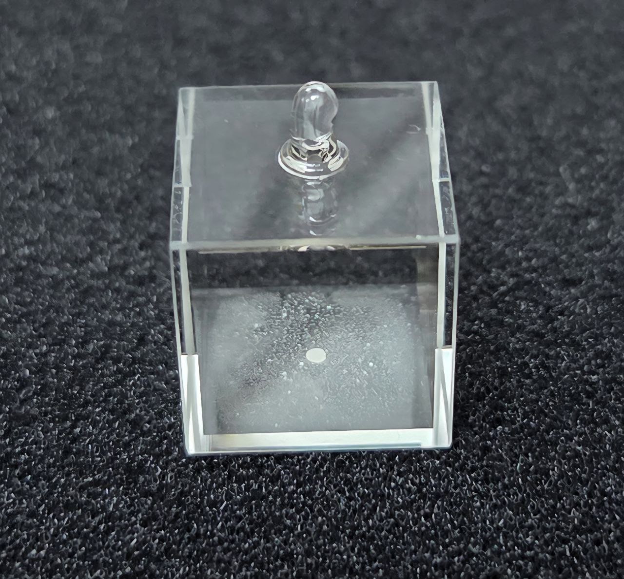
Atomic Vapor Cell
At the core of every OAQ sensor sits an atomic vapor cell. Its atoms react to the faintest magnetic field, turning quantum behaviour into a measurable signal.

OAQ builds quantum magnetic-field sensors that reveal what optical and surface-level sensing can miss: concealed, buried, and submerged objects. They turn faint magnetic anomalies into an operator-ready map.
Quantum magnetometers measure the magnetic field with extraordinary sensitivity. Where optical, GPS, and surface-level sensing fall short, OAQ adds a magnetic layer, resolving the faint anomalies left by metal, structure, and movement: buried ordnance, hidden infrastructure, and vehicles or vessels beneath cover.
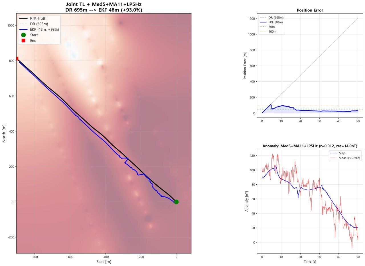
Picotesla-class sensitivity. Field-oriented anomaly mapping. Designed to operate outside magnetic shielding.
At the core of every OAQ sensor sits an atomic vapor cell. Its atoms react to the faintest magnetic field, turning quantum behaviour into a measurable signal.
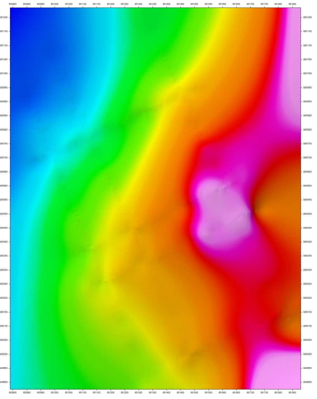
Resolve magnetic signatures far below the floor of conventional sensors, flagging concealed objects long before they're visible by any other means.
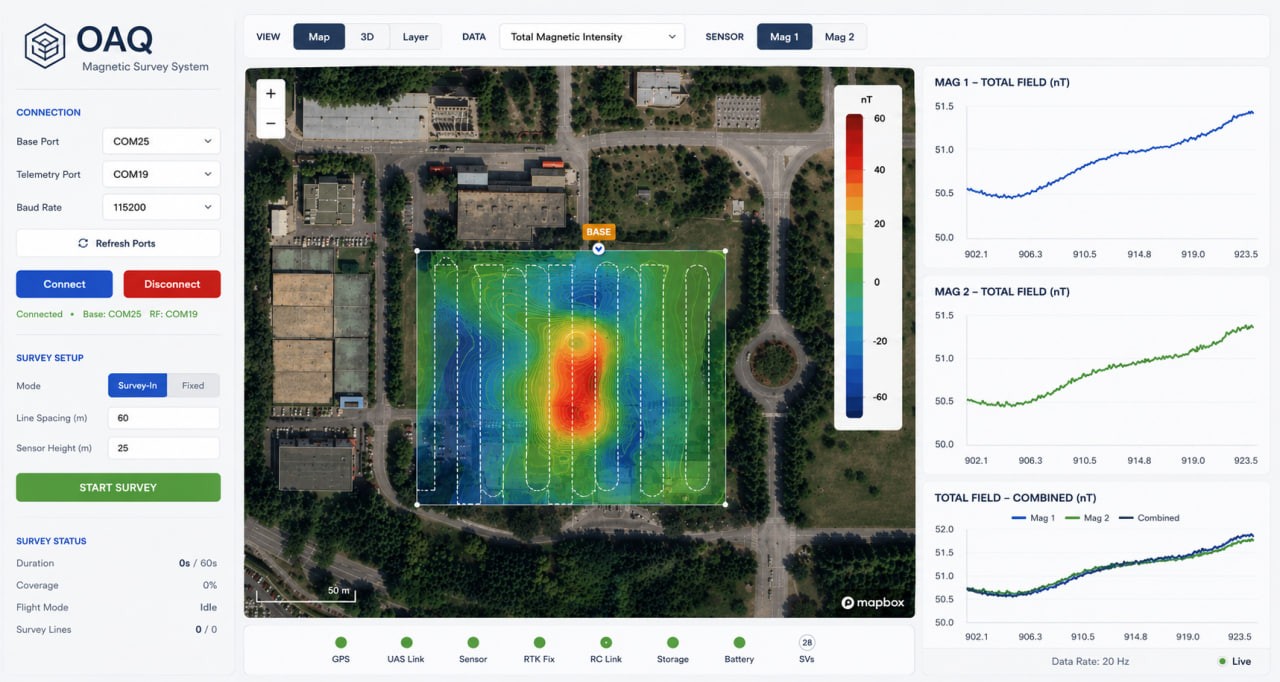
Drone, vehicle, or vessel-mounted sensors survey the terrain and stitch each reading into a continuous magnetic anomaly map.
Candidate hazards are marked as they're found, helping operators plan a lower-risk route for the people and vehicles that follow.
OAQ unifies quantum magnetic sensors, anomaly analysis, and shared mapping into a single platform, so teams surface hidden signatures and act on them from one view.
Deployed across drones, vehicles, and fixed installations, OAQ integrates with the systems you already operate.
Our atomic vapor cells and lightweight sensor heads are built in-house: the core quantum components behind every OAQ system, and the foundation for what we build next.
Quantum sensors read the magnetic field at picotesla-class sensitivity, from a drone, vehicle, or vessel.
Each reading is stitched into a continuous magnetic anomaly map of the surveyed area.
Candidate anomalies are flagged so operators can decide where to inspect, avoid, or proceed.
We resolve the magnetic field at picotesla-class sensitivity, fine enough to surface subtle anomalies in mobile field conditions.
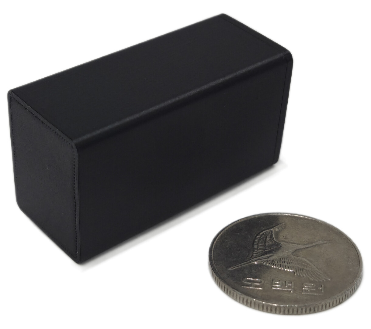
7× lighter than our first generation. Light enough to fly on small drones, with no magnetic shielding.
One magnetic signal layer, applied across the field.
Surface concealed and buried objects where optical and surface-level sensing fall short.
Map suspected buried ordnance to support safer clearance planning.
Survey for submerged objects and vessels beneath the surface.
Locate hidden utilities and structures before you dig or build.
Tell us what you need to see. Our team will follow up to explore how OAQ fits your environment.
In collaboration with
Selected R&D collaborators


Technology transfer

MOU